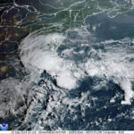
MIAMI — Heavy wind and rain from a storm in the Atlantic that wasn’t quite organized enough to get a name hit a stretch of the southeastern coast Monday.
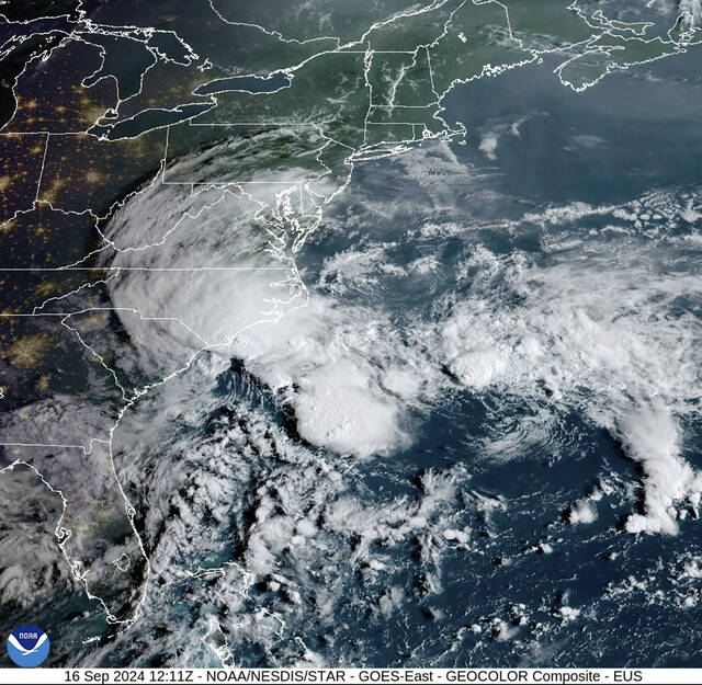
The center of the storm system was expected to reach the South Carolina coast Monday afternoon and then move inland across the Carolinas through Wednesday, the U.S. National Hurricane Center said. Damaging wind was spreading onshore and dozens of roads were flooded.
The system didn’t have an official name yet, and forecasters weren’t sure if Potential Tropical Cyclone No. 8 would ever organize enough to be named Helene.
WATCH: Flooding hits Carolina Beach from Potential Tropical Cyclone Eight. pic.twitter.com/8ds18A8xXb
— The Weather Channel (@weatherchannel) September 16, 2024
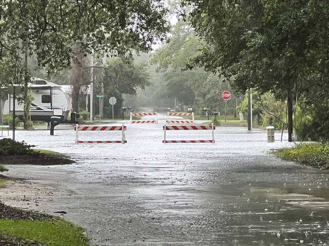
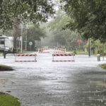
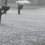
But no matter its classification, the storm prompted school closings, including Coastal Carolina University, and flooded the streets south of Wilmington, North Carolina, with more than a foot of rain while nearby Wrightsville Beach had a wind gust of 65 mph.
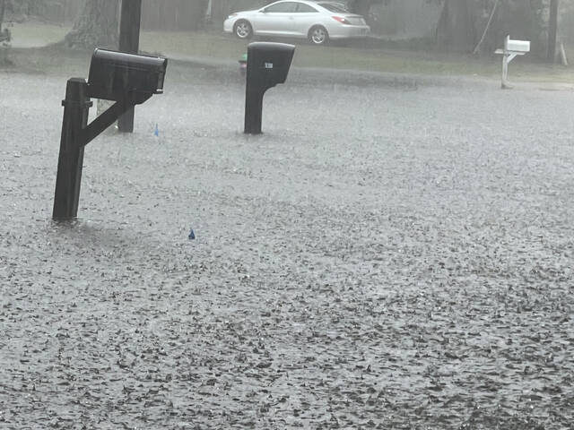
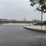
In Brunswick County, North Carolina, flooding reached waist high in areas around the courthouse, the Sheriff’s Office said. About 15 miles away in Carolina Beach, dozens of vehicles had floodwaters up to their doors as officials urged people to stay home. Radar estimated up to 18 inches of rain fell in the area.
A tropical storm warning was in effect from the South Santee River north of Charleston, South Carolina, northward to Ocracoke Inlet, near the southernmost extreme of North Carolina’s Outer Banks.
Truly historic flooding currently ongoing in Carolina Beach, North Carolina today as #PTC8 continues to drench the region. #NCwx pic.twitter.com/0maLlNYU0v
— WeatherNation (@WeatherNation) September 16, 2024
Monday afternoon, the low-pressure system was centered about 90 miles east-northeast of Charleston and about 60 miles south-southwest of Cape Fear, North Carolina. It had maximum sustained wind of 40 mph and was moving to the north-northwest at 5 mph, forecasters said.
The system still had a chance of becoming a tropical or subtropical storm, but forecasters said those chances are decreasing because it was becoming less organized. That means the strongest winds in the storm are in outer rain bands instead of near the center, said Carl Morgan, a meteorologist at the National Weather Service’s office in Wilmington.
Wow. Here's what "Potential Tropical Cyclone Eight" can do despite never getting a name. It has produced nearly 20 inches of rain in and around Carolina Beach in North Carolina over the past 24 hours. Significant flooding occurring from this storm.#alwx @WBRCnews pic.twitter.com/8lwsR51cNS
— Matt Daniel (@mattdanielwx) September 16, 2024
“There are still strong winds out there. They just not concentrating near a center,” Morgan said.
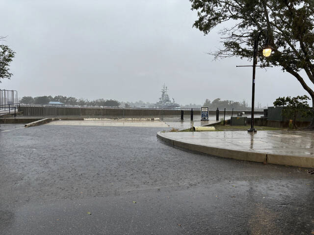
Areas along the coast are already experiencing higher water levels thanks to King Tides this week while the moon is the closest to Earth in its orbit. Charleston was not predicting major flooding, but officials warned residents to be ready in case heavy rain came at high tide.
In an updated hurricane outlook last month the National Oceanic and Atmospheric Administration was still predicting a highly active Atlantic hurricane season thanks to near-record sea surface temperatures and the possibility of La Nina. Emergency management officials have urged people to stay prepared.
Maximum winds were expected to decrease as the low approached the coast, but tropical storm-force winds were still expected within the warning areas. The system will likely dissipate over the Carolinas by late Wednesday, forecasters said.
The storm was expected to dump 4 to 8 inches of rain in northeast South Carolina into southeast North Carolina and up to 10 inches in isolated spots, with smaller amounts expected across the remainder of North Carolina through Tuesday, according to forecasters.
Over much of Virginia, 1 to 3 inches of rainfall, with locally higher amounts, were expected from Monday night through Wednesday. The hurricane center predicted the rainfall could lead to isolated and scattered flash and urban flooding, as well as minor river flooding.
[6 AM] Potential Tropical Cyclone 8 remains southeast of Charleston, SC this morning. Expected impacts have not changed! More information can be found on our briefing page: https://t.co/gH82utMhB1 pic.twitter.com/KaZfhFJ61d
— NWS Charleston, SC (@NWSCharlestonSC) September 16, 2024
Elsewhere in the Atlantic, Tropical Storm Gordon weakened to a depression as it swirls through open ocean waters. Gordon could either dissolve in upcoming days or strengthen back into a tropical storm, forecasters said.