Western Pennsylvania's trusted news source
Environmental survey underway for Laurel Valley Transportation Improvement Project | TribLIVE.com
Westmoreland

Environmental survey underway for Laurel Valley Transportation Improvement Project

Megan Tomasic
2778398_web1_GTR-MtpleasantDig-13-063020
Shane Dunlap | Tribune-Review
Field technician Sonja Williams, left, sifts through soil for evidence of any human activity, while environmental scientist Tristan Sandrosky, right, shovels soil as part of a cultural survey dig on Monday in Mt. Pleasant Township. The survey is being conducted by a team from Philadelphia-based engineering firm McCormick Taylor to determine if any future road or civil engineering projects would impact a site of cultural significance. The team of archaeologists will be continuing to work in the area for the next three days.
2778398_web1_GTR-MtpleasantDig-16-063020
Shane Dunlap | Tribune-Review
Archaeologist Katherine Peresolak uses a Munsell soil color chart to determine past human activity on a layer of soil while conducting a cultural survey dig on Monday in Mt. Pleasant Township. The survey is being conducted to determine if any future road or civil engineering projects would impact a site of cultural significance.
2778398_web1_GTR-MtpleasantDig-14-063020
Shane Dunlap | Tribune-Review
Field technician Sonja Williams examines a rock with environmental scientist Tristan Sandrosky, right, while using a sifting table to conduct a cultural survey dig on Monday in Mt. Pleasant Township. The survey is being conducted to determine if any future road or civil engineering projects would impact a site of cultural significance. The team of archaeologists will be continuing to work in the area for the next three days.
2778398_web1_GTR-MtpleasantDig-15-063020
Shane Dunlap | Tribune-Review
Field technician Sonja Williams, center background, uses sifting tables along with archaeologists Allison Brewer, left, and Katherine Peresolak, right, while conducting a cultural survey dig Monday in Mt. Pleasant Township.
2778398_web1_GTR-MtpleasantDig-12-063020
Shane Dunlap | Tribune-Review
Field technician Sonja Williams sifts through rock and soil for signs of human activity during a cultural survey dig Monday in Mt. Pleasant Township.
2778398_web1_gtr-LVTranspSec1map-012420
Three roundabouts and two off-line segments are among the features proposed for the southern section of the Laurel Valley Transportation Improvement project, expected to be under construction beginning in 2021 along the Route 981 corridor north of Mt. Pleasant.

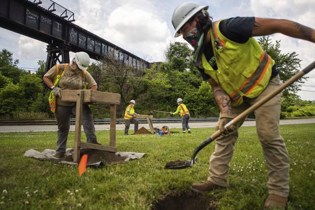
Initial phases of the Laurel Valley Transportation Improvement Project are underway in Mt. Pleasant Township, marked by an environmental survey.

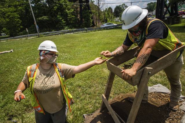
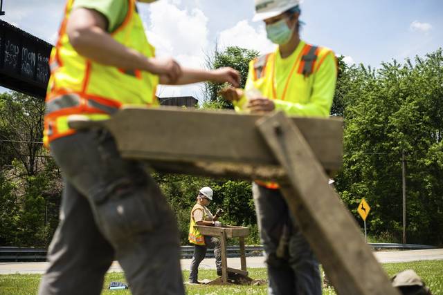
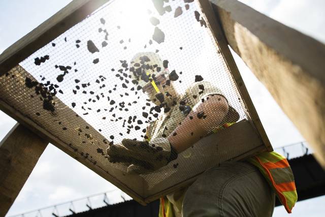
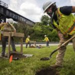
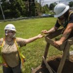
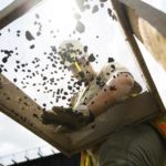
Located at the intersection of Route 819 and Route 981, four archaeologists in hardhats and yellow safety vests dug two holes this week, sifting through soil in search of natural and cultural resources that could impact the path of the project, a process that is conducted before almost all PennDOT projects.

“If we find something significant, we would recommend that it is avoided, if possible, by engineering,” said Allison Brewer, senior archaeologist for McCormick Taylor, a civil engineering firm based in Philadelphia. “Right now, we’re collecting a lot of data to guide that type of design element.”

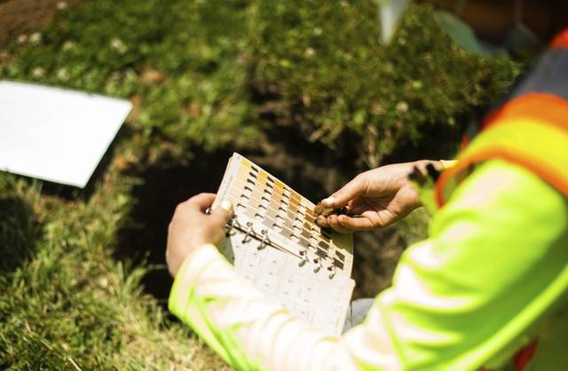
Brewer noted the group typically looks for artifacts that could suggest the site was once home to Native Americans or historic farmsteads, although a soil color chart also is used to determine past human activity. So far, glass, a piece of brick and other small fragments were recovered from the site.

According to Brewer, settlements in the Mt. Pleasant area date back to the 1700s, “so there’s a lot of potential for those types of things to be present.” She noted that she did not necessarily expect to find many artifacts where crews were digging Monday.

So far, wetland, surface water and stream field investigations were conducted and mapped for the first phase of the project to help engineers avoid those features during final design phases. Officials also conducted interviews with area farmers to discuss farm operations and use of local roadways.

The project originally was proposed in 2016 and may not conclude until around 2026, according to a preliminary schedule.

The first phase will cover more than 4 miles, starting at the Route 819 and Route 981 intersection and extending to Route 2023 in Norvelt. Work will follow Route 981, with the exception of some shifts to improve the roadway. Construction could last from 2021 to 2023.

The second phase will cover more than 3 miles, picking up where the first phase leaves off and extending to the Route 2023 and Route 130 intersection in Unity. Construction for the second phase is expected to last from 2025 to 2026.

The third phase will extend the project from the intersection to Route 981 near the Arnold Palmer Regional Airport. Construction on that phase could run from 2024 to 2025.

Remove the ads from your TribLIVE reading experience but still support the journalists who create the content with TribLIVE Ad-Free.

Get Ad-Free >

Categories: Local | Westmoreland
";