https://naviga.triblive.com/local/regional/strong-winds-expected-isolated-tornadoes-possible-with-storms-in-afternoon-evening/
Tornado watch issued for most of southwestern Pennsylvania

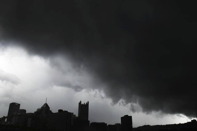
The National Weather Service in Pittsburgh issued a tornado watch on Wednesday afternoon for most of southwestern Pennsylvania.
The watch, which lasts until 10 p.m., is also in effect for parts of Ohio and West Virginia.
A tornado watch has been issued for parts of Ohio, Pennsylvania and West Virginia until 10 PM EDT pic.twitter.com/uDrTFhgBad— NWS Pittsburgh (@NWSPittsburgh) September 22, 2021
There will be strong winds with isolated tornadoes possible late Wednesday afternoon into early evening as a cold front crosses the region, a National Weather Service meteorologist said earlier Wednesday.
A line of storms is expected to pass through between 4 p.m. and 9 p.m., meteorologist Rich Redmond said.
If there’s sunshine later in the morning and early afternoon, it would help destabilize the atmosphere and create a higher risk for storms to develop, he said.
“We do have ingredients in place today where those storms could become severe,” he said. “We’re going to have to wait and see if we can get any sunshine later today.”
The main threat will be damaging winds with gusts over 60 mph. Isolated tornadoes are not out of the question, Redmond said.
Models over the last few days have highlighted that today's environment may be favorable for producing tornadoes. Therefore, The Storm Prediction Center upgraded the tornado chances from 2 to 5%.Below is an onset time graphic to help plan your day around strong storms. pic.twitter.com/XiYH7r84IN
— NWS Pittsburgh (@NWSPittsburgh) September 22, 2021
Until 4 p.m., it will be a gloomy day with scattered showers and sprinkles. There could be a break in the rain later in the morning.
The heaviest rain that had been expected this morning shifted east toward central Pennsylvania, Redmond said. Any heavy rain in the Pittsburgh area will come later with the cold front and storms.
The temperature will fall significantly, with a lot of colder air coming in behind the front. After a high of 75 Wednesday, it will struggle to reach 60 on Thursday, Redmond said.
It will warm up for the weekend, with highs near 70.
“I think our 80s may be over for a long while,” Redmond said.
Copyright ©2026— Trib Total Media, LLC (TribLIVE.com)