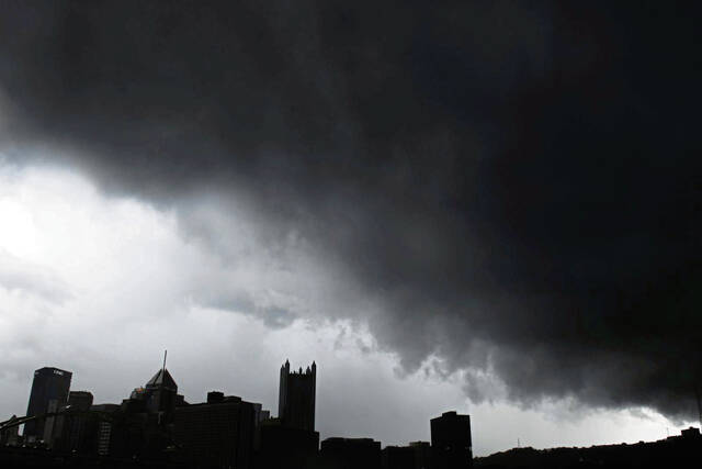
The conditions are right for severe weather Tuesday, according to the National Weather Service.
The Pittsburgh area may see tornadoes, damaging wind and large hail.
The National Weather Service office in Moon issued a severe storm warning for much of Ohio — particularly Zanesville and New Philadelphia. The warning also covers into West Virginia and Pittsburgh.
Any storm that produces tornadoes, hail larger than an inch or wind gusts more than 58 mph is considered severe, said National Weather Service Meteorologist Jared Rackley.
“For the Pittsburgh area, we could see any of those tomorrow or a combination of those with any of the stronger storms that move through,” Rackley said.
Moderate Risks for our area are rare. The last Moderate Risk for our area was in 2014. https://t.co/T2OBR1FwnK
— NWS Pittsburgh (@NWSPittsburgh) April 1, 2024
An enhanced to slight risk of severe storm conditions is expected east of the city, in areas like Westmoreland County.
“You’re still looking at a higher-end threat than an everyday thunderstorm,” Rackley said, “but what will come out of it may not be quite as widespread and may not be quite as high confidence.”
The Pittsburgh area can expect the whole gamut of severe weather as storms roll in from Ohio, said WTAE Chief Meteorologist Mike Harvey.
“The storms will die down a little bit before they get to us, but not much,” Harvey said.
Tornadoes cannot be ruled out of possibility, he said.
The Pittsburgh area is likely to see rain early Tuesday morning, but severe storms are not forecast until late afternoon, around 4 p.m., Rackley said. Severe storms should be cleared by midnight, but typical thunderstorm conditions may continue into early Wednesday morning, he said.
“It’s a pretty large-scale storm system that’s moving through, associated with low pressure,” Rackley said of the severe storm forecast. “And this initial wave is the warm front that’s lifting north. The cold front will pass through earlier on Wednesday.”
NEW: Tuesday’s severe weather threat has escalated with a TOR:CON up to 7 for most of Ohio, indicating the possibility of EF2 or stronger tornadoes.
— The Weather Channel (@weatherchannel) April 1, 2024
We have more details on air and on our TV app: https://t.co/Feaf8zT3Ip pic.twitter.com/s1FNNkk1HR
Heavy rain could start as early as 11 p.m. Monday and run through early Tuesday morning before picking up again in the evening, Harvey said. The rainfall could result in minor flooding.
“Just be weather aware and have a place to get inside, especially tomorrow evening,” Harvey advised.