https://naviga.triblive.com/local/regional/after-morning-snow-above-average-temperatures-rain-forecast-for-western-pa-region/
After morning snow, above average temperatures, rain forecast for Western Pa. region

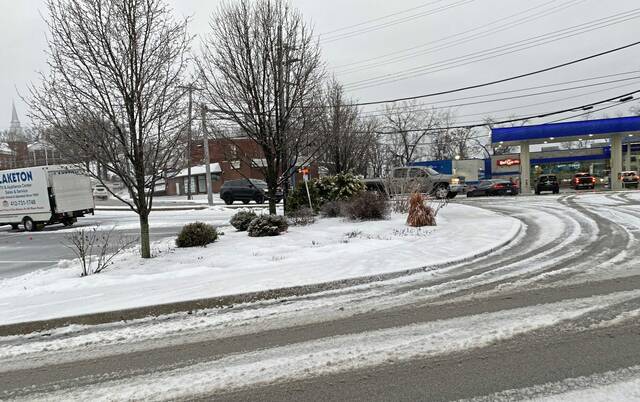
After accumulations of snow this weekend and again Tuesday morning, the Western Pennsylvania region can expect rain and higher temperatures this week.
Despite a morning that featured slick road conditions amid a mix of snow and rain, Tuesday’s forecast will see a high of 51 degrees, said John Darnley, observation program leader at the National Weather Service Pittsburgh office.
“We’re in this warm sector of this system,” Darnley said.
These temperatures, Darnley said, fall higher than the normals for January — a low of 31 and a high of 36 degrees. Normals, he said, are determined every decade by compiling weather data from the past 30 years.
Tuesday morning’s conditions prompted dozens of school districts to call for two-hour delays. Click here for WTAE’s list of school closings and delays.
Following an initial dusting of snow early Tuesday morning, Darnley said Pittsburghers can expect rain for the rest of the day — up to an inch and a quarter.
High winds are in the forecast, ranging from 40 mph up to 60 in areas near Latrobe, Indiana and Uniontown.
Strong winds today! The Wind Advisory (gusts to 50mph) has been expanded to include all western PA and northern WV lowlands. The High Wind Warning (gusts to 60mph) remains in effect for the high terrain and adjacent areas. Gusts 40-45 mph expected in eastern OH. #pawx #wvwx #ohwx pic.twitter.com/7KJk87vXfh— NWS Pittsburgh (@NWSPittsburgh) January 9, 2024
Possible snow showers are expected for Wednesday morning, Darnley said. Temperatures could be in the 40s for the rest of the week, with a low of 29 forecasted for Thursday.
Copyright ©2026— Trib Total Media, LLC (TribLIVE.com)